
HOW DID PEOPLE NAVIGATE ICELAND BEFORE GPS? THEY HAD THE MAP IN THEIR HEADS

Today, all we have to do is type a destination into our phone and a blue line appears, showing us exactly where to go. We know how many kilometres remain, how long the journey will take and precisely where we are. In Iceland, however, it only takes a few minutes out in the landscape to realise just how dependent we have become on such aids. The wind can erase tracks, fog can hide a mountain, and a landscape that seemed easy to read only moments earlier can suddenly turn into a vast space with no obvious landmarks.
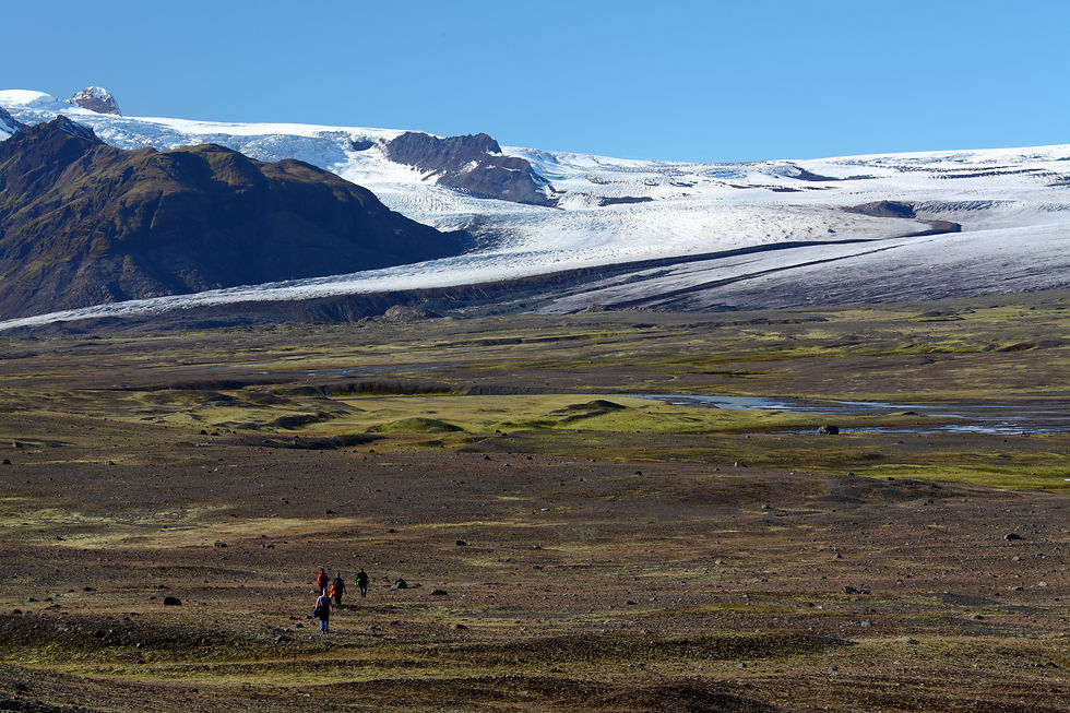
The first inhabitants of Iceland had none of this. No GPS, no mapping apps and no roads telling them which way to go. Yet they were able to travel across the country.
Because the landscape was not simply something they travelled through. It was their map.
The landscape was not empty
To a modern traveller, the Icelandic wilderness can look like a vast expanse with very few landmarks. To someone who lived there, it was full of information.
A mountain had a name. A river had a ford. A valley had a route through it. A rock, hill or unusual lava formation could serve as a landmark telling people where they were.
And, most importantly, people knew what each place meant.
They knew where a river could be crossed. Which route was passable in summer but impossible in winter. Where water could be found. Which valley was easy to cross and which could become a serious obstacle after heavy rain.
This knowledge was not stored on maps.
It was passed from one person to another.
A mountain could be better than a compass
Mountains were, naturally, among the most important landmarks.
Today, we look at a map, check the direction and calculate the distance. A medieval Icelander might have known a mountain so well that its shape alone was enough to establish his position.
He knew what it looked like from different directions, where it would appear on the horizon and what lay beyond it.
This was how a mental map of the landscape was built.
And that is why it was not enough simply to know where to go. You also had to know what you were supposed to see along the way..
Iceland can play tricks on distance
But even seeing the landscape clearly does not necessarily mean you can judge distance correctly.
In Iceland, there is something that can seriously deceive visitors on a clear day: mountains often look much closer than they really are.
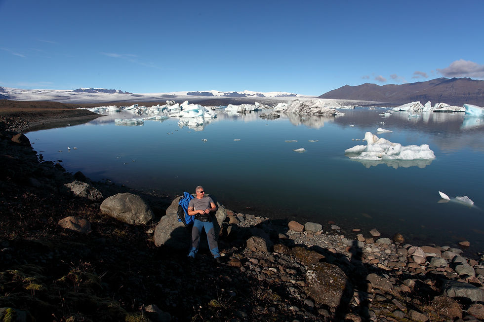
I experienced this myself at Jökulsárlón in 2010. A few friends and I decided to walk around the glacier lagoon from the parking area towards the glacier front, where ice breaks off and drifts into the lagoon.
The weather was almost perfect – close to 25°C and virtually no wind. Looking across the lagoon towards the glacier, the other side seemed almost within reach. We estimated that, at worst, we would walk about four kilometres each way.
We set off at around 11 in the morning.
The route, however, was nowhere near as easy as it looked from a distance. We had to cross several glacial rivers. The water was painfully cold, and in some places it reached our waists. Every crossing was more than just an inconvenience. It was a genuinely painful experience, with sharp stones under our feet and freezing water numbing our legs.
And gradually, we realised just how badly we had misjudged the distance.
Instead of the eight kilometres we had expected, we ended up walking 22 kilometres. The journey there and back took six hours.
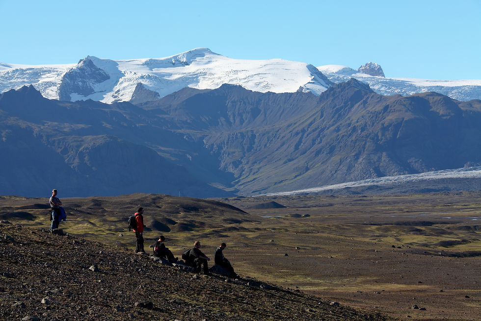
All of this happened in a landscape where we had felt, almost the entire time, that our destination was right in front of us.
That is what makes Icelandic landscapes so deceptive.
You can see a mountain, a glacier or another destination perfectly clearly – and it still does not mean that it is close.
Part of the reason is exceptionally good visibility. Under favourable conditions, the Icelandic air contains relatively few particles that create the atmospheric haze we are used to in much of continental Europe. The Icelandic Meteorological Office notes that in good conditions, mountains can remain clearly visible from distances of 100 to 200 kilometres.
In Central Europe, we are accustomed to distant hills gradually disappearing into a bluish haze. Paradoxically, that haze helps us judge distance. The farther away the landscape is, the less detail and contrast we normally see.
In Iceland, that visual measuring stick can largely disappear on a clear day.
The result is a strange sensation that the landscape is smaller than it really is.
You can see the mountain perfectly – but that does not mean it is anywhere near you.
For someone travelling on foot, this was not merely an optical illusion. It made knowing the actual terrain, route and distances between places even more important.
The landscape could not be measured by sight. It had to be known.
A route was not a line on a map
Today's map shows us a route as a line.
In medieval Iceland, such a line often did not exist.
A route could depend on the season, the weather or the state of a river. What was passable in summer might be impossible in winter. Heavy rain could turn a ford into a dangerous river. Snow could cover a route that someone had known all their life.
Knowing a route therefore meant knowing not only where, but also when.
A river was not simply a river
To a modern tourist, a river is an obstacle shown on a map.
To someone who travelled through the landscape regularly, it had a very specific character. They knew where it could be crossed, how deep it usually was and how it changed with weather and snowmelt.
Glacial rivers are particularly unpredictable. Their flow can change rapidly, and a crossing that was safe yesterday may not be safe today.
Such knowledge could not simply be drawn on a map.
It was part of experience.
And then came the fog
The greatest test must have been the moment when all the distant landmarks disappeared.
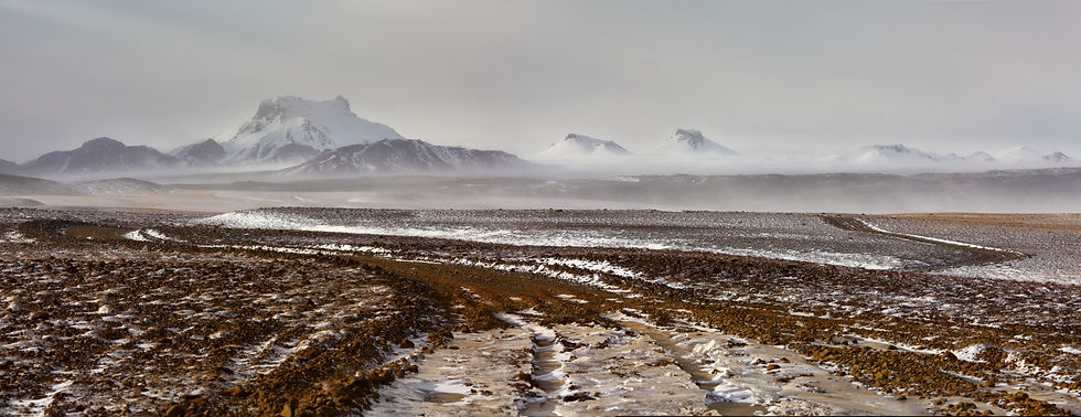
Icelandic fog can hide mountains and the surrounding landscape within minutes. Suddenly, there is no obvious indication of where the route leads.
Someone who knew the landscape, however, did not have to rely on a single distant mountain. They could remember the route as a sequence of smaller features: a stream, a particular rock, a change in the ground, a bend in a valley, a ford and then another landmark.
They were, in effect, reading the landscape.
The Icelandic landscape has a memory
Names were an important part of this knowledge.
Iceland has an extraordinarily rich tradition of place names. The Landnámabók, the Book of Settlements, which describes the settlement of Iceland, records more than 1,500 place names.
These names often describe the character of the landscape, its location or an event associated with a particular place.
A name was therefore more than a label on a map.
It was part of the story of the place.
A place name was a little map
When someone mentioned the name of a particular place, others could picture a specific part of the landscape.
Some names referred to the shape of the terrain, others to water, vegetation, animals or events that had taken place there. Place names helped preserve knowledge of the landscape from one generation to the next.
People did not necessarily need a map with a precisely marked route.
They needed to know the names of places, how those places related to one another and how to travel between them.
The sky helped, too
The landscape was not the only navigational aid.
When the weather allowed it, the movement of the sun and the stars could help establish direction. Knowing the cardinal directions was useful on longer journeys, particularly in places where there were few obvious landmarks.
But Icelandic weather has a way of changing everything within minutes.
That is why knowledge of the landscape was more important than any single method of navigation.
The sagas can show us the way – but with caution
We can also learn about Icelandic landscapes and journeys from the Icelandic sagas. Their descriptions of places, routes and natural features can be remarkably specific.
But they need to be treated with caution.
Most of the best-known sagas were written down in the 13th and 14th centuries and describe events from earlier periods. They are therefore not navigation manuals written by contemporaries of Iceland's first settlers.
Nevertheless, they reveal how important landscape, place names and spatial knowledge were in Icelandic culture.
The landscape is not merely a backdrop to the stories.
It is part of them.

And then came the maps
Only later did knowledge of the landscape increasingly become something that could be transferred onto maps.
What earlier generations had known by heart – mountains, rivers, fords, valleys and routes – gradually found its way onto paper.
A map did something rather remarkable.
It transferred knowledge of the landscape from human memory into an image.
Today, we have reversed that process. We have maps on our phones, GPS and precise positioning. We do not have to remember the name of a mountain or know where the nearest ford is.
Our phones will tell us.
Our ancestors had no blue dot.
No satellite.
No Google Maps.
They had mountains, rivers, valleys, light and wind – and above all, memory.
They had to learn how to read the landscape.
And perhaps that is why they knew it in a way that most of us no longer do.
We have a map of the landscape. They had knowledge of the landscape.

About the Author
Iceland has fascinated me for many years. Over the course of numerous journeys across the island, I have driven tens of thousands of kilometers, experienced storms that changed travel plans within minutes, and witnessed days when choosing the right route meant discovering places that most visitors never see. I documented many of these experiences in my documentary film Island in the North.
Through this website, I share practical travel advice, up-to-date information, and firsthand experiences from the field to help others explore Iceland more safely and gain a deeper understanding of its unique landscapes and ever-changing nature.


Komentáře